March 5, 2026
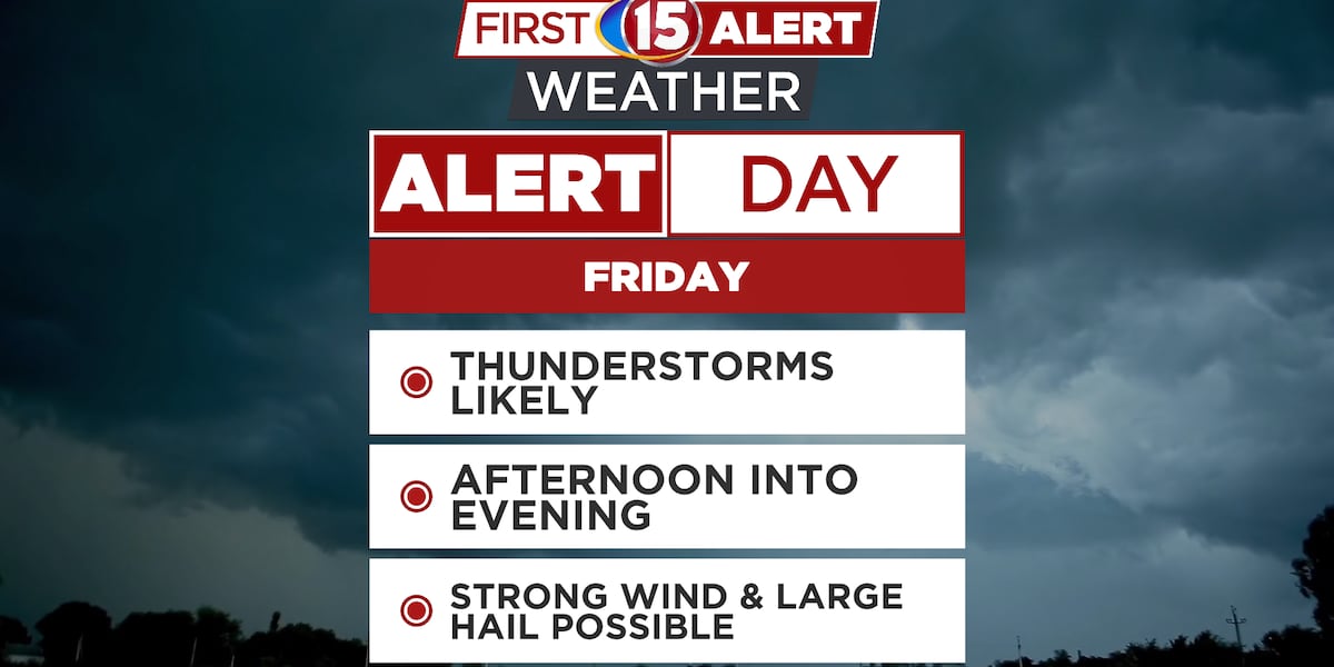
First Alert Day Friday – Severe Storms are Possible
Highs in the middle to upper 40s across southern Wisconsin today • Highs in the 70s by Monday and Tuesday MADISON, Wis. (WMTV) – A wave of low-pressure tracking across the Illinois is the primary driver for our current weather shift in South Central Wisconsin. As this surface low slides to our south today, it […]
Highs in the middle to upper 40s across southern Wisconsin today
• Highs in the 70s by Monday and Tuesday
MADISON, Wis. (WMTV) – A wave of low-pressure tracking across the Illinois is the primary driver for our current weather shift in South Central Wisconsin. As this surface low slides to our south today, it is pulling a plume of moisture into the Madison area, resulting in light rain and drizzle early today.
From a weather perspective, we are positioned on the cooler, northern flank of the system, which is keeping the atmosphere stable enough to suppress thunderstorm activity for now. Temperatures today will hold fairly steady, peaking in the middle 40s.
As we move into Friday, a much more robust mid-latitude low pressure system developing over the Rockies will track toward the Upper Mississippi Valley. This will tighten the pressure gradient across the region, shifting our winds to the south and ushering in a much more active pattern.
This second system brings high confidence for widespread rainfall and the potential for embedded thunderstorms as we enter the warm sector of the storm.
Some of the thunderstorms Friday afternoon and evening could be strong or severe, producing damaging, wind, and large hail. First Alert meteorologists have declared Friday a First Alert Day due to this threat. Highs on Friday will reach the upper 50s before a cold front sweeps through on Saturday.
By Sunday and Monday, the area will see a brief reprieve with clearing skies and temperatures returning to the 60s. However, the models are pointing toward another significant transition by mid-week.
A strong cold front is expected to clear the area by Wednesday, ushering in a polar air mass. This rapid drop will plunge temperatures into the lower 40s, likely turning any remaining precipitation into snow showers to end the period.
Click here to download the WMTV15 News app or our WMTV15 First Alert weather app.…Read more by Charlie Shortino